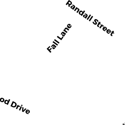
4 ALDERWOOD DRIVE
Owner Information
WILLIAMS BENJAMIN M. & DIANNA M.
123 SHERIDAN STREET
NORTH EASTON, MA 02356


Property Details
4 ALDERWOOD DRIVE is classified as a Developable Residential Land (Vacant land).
4 ALDERWOOD DRIVE is valued at $291,300. The land is valued at $291,300 and the structures are valued at $0.
This property is in Zone RES. Confirm with local Zoning Board authorities to ensure there are no overlays or other easements on this property.
The most recent deed for 4 ALDERWOOD DRIVE is recorded at the local registrar in Book 26122, Page 159. 4 ALDERWOOD DRIVE was last sold on Tuesday, July 21, 2020 for $328,000.
Assessment data from fiscal year 2022.
Flood Data
According to the FEMA National Flood Hazard Layer, this property does not appear to be in a flood zone. It may also be in an area not yet reviewed. Nonetheless, confirm this information prior to taking any action.
To view the flood hazards around this property, create a FEMA "Firmette" Map of the area around 4 ALDERWOOD DRIVE.
Broadband Internet Providers
| Provider | Type | Bandwidth (mbps) | |
|---|---|---|---|
| Viasat Inc | Satellite | 100 | 3 |
| Verizon New England Inc. | DSL | 5 | 0 |
| Verizon New England Inc. | Fiber | 940 | 880 |
| Comcast | Cable | 1000 | 35 |
| T-Mobile | Fixed Wireless | 25 | 3 |
| VSAT Systems, LLC. | Satellite | 2 | 1 |
| HughesNet | Satellite | 25 | 3 |
| GCI Communication Corp. | Satellite | 0 | 0 |
Broadband service provider data from December 2020.
Adjacent Properties
- 6 ALDERWOOD DRIVE
Developable Residential Land owned by DOAN ANH - 46 RANDALL STREET
Single Family Residential owned by CHARLES RIVER ASSOCIATION FOR RETARDED CITIZENS INC - 38 RANDALL STREET
Developable Residential Land owned by ROCHE CAITLIN - 91 SUMMER STREET
Developable Residential Land owned by DALY JR. RAYMOND F. TR